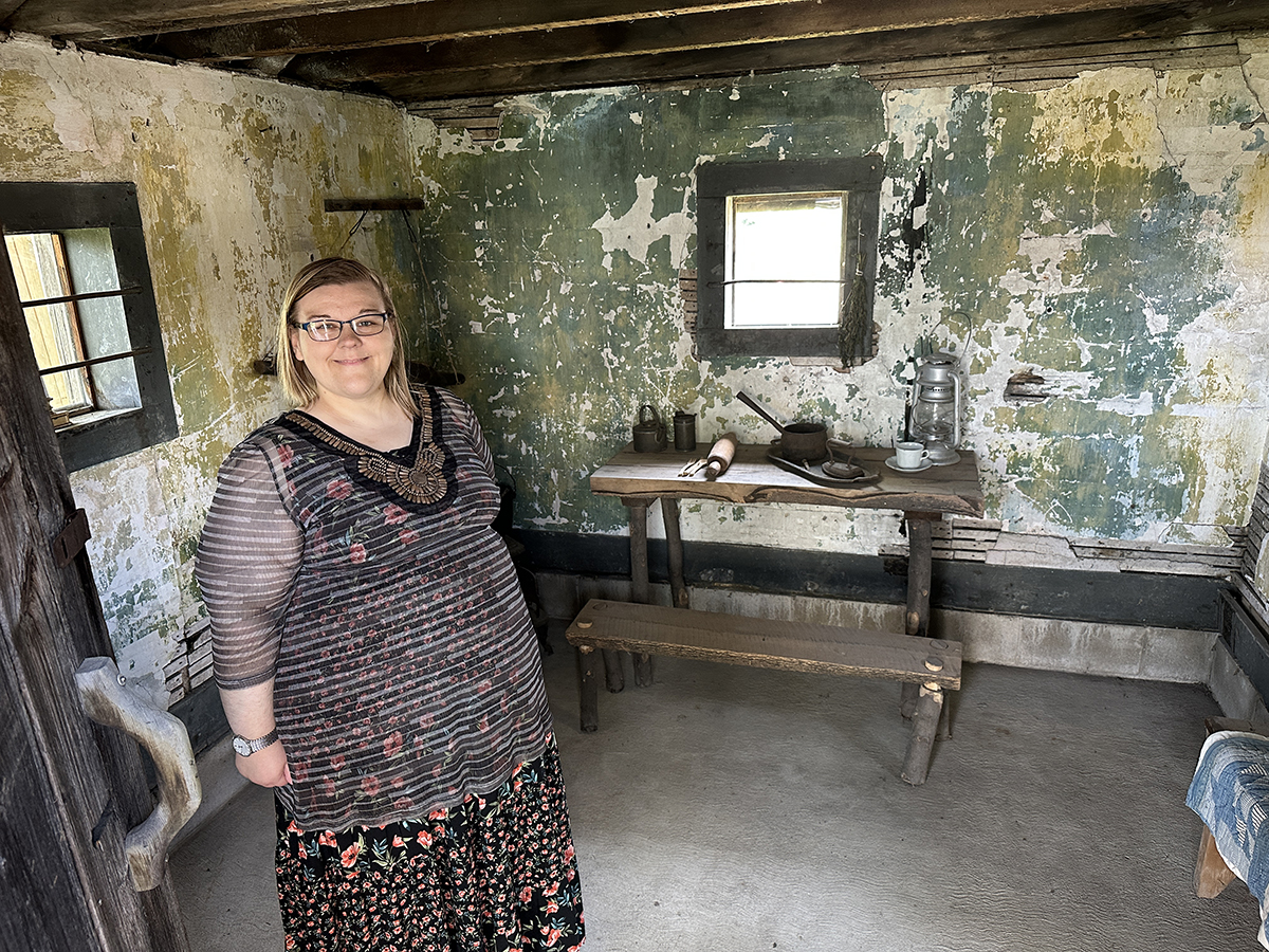
Still standing (with some help) after 200 years
Conservation area issues flood watch in Lambton
July 10, 2024
As the rain from the remnants of Hurrican Beryl continues, the St. Clair Region Conservation Authority has issued a flood watch.
Read the details below.
Environment Canada meantime says the showers should end tonight around midnight, although there is still a 40 per cent chance of showers. The winds will remain high with gusts of up to 70 km per hour.
St. Clair Region Conservation Authority Flood Watch
Highlights:
· 30 to 75 mm of rain over the past 24 hours
· Elevated water levels, potential for flooding
· Saturated soils; increased runoff and ponding
· Road closures are expected
Message: Heavy and constant rainfall has lead to elevated water levels
Over the past 24 hours the St. Clair Region Conservation Authority watershed has received between 30-75mm of rain due to post tropical storm Beryl. At this time, it is predicted for an additional 5-10mm of rain this evening and overnight. As a result, water levels across the watershed are rising and have yet to peak. Localized flooding in low-lying areas; floodplain, agricultural and parkland is anticipated.
As water levels continue to rise, the following roads may become impacted:
· Stanley Line between Kimball Road and Waubuno Road
· Wabuno Road between Bickford Line and Oil Springs Line
· Pretty Road north of McCallum Line
· Waterworks Road north of Courtright Line
· Tefler Road between Courtright Line and Moore Line
Individuals are reminded to avoid watercourses and flooded areas due to dangerous conditions, slippery banks and cold, swift moving water. Children and pets should be kept away from the water.
The Conservation Authority continues to monitor watershed conditions and will issue advisories to municipalities and media should flood issues arise
NEXT
Petrolia considers raising fixed water rates
PREVIOUS
Petrolia to replace dugouts at Greenwood, Kerr and Bridgeview
Front Page
Still standing (with some help) after 200 years
July 12, 2025
Heather Wright/The Independent When Abraham Smith and his wife, Anna Hoy, arrived on the shores of the St. Clair River, there was nothing but trees which blocked out the sun. The couple landed around what we now know as the St. Clair Parkway and Smith Line in 1820, along with two children and another family, and settled in the area.
Read More
Front Page
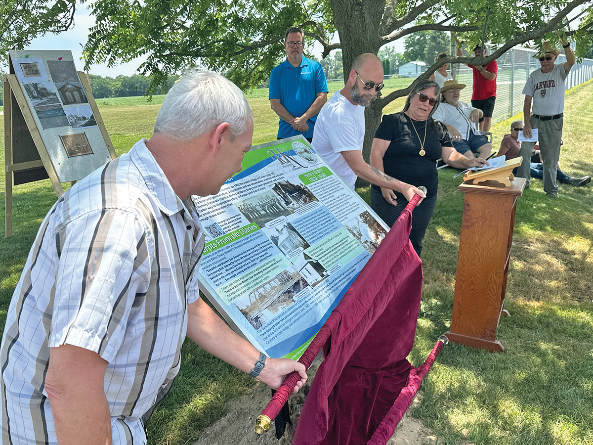
Remembering Croton
July 12, 2025
Heather Wright/The Independent Harold Snary stands under a tree in the postal village of Croton. Those standing with him see a new, siding-clad school and church, a few homes and the traffic whizzing down Oakdale Road. At the corner of Oakdale and Croton Road, they might notice the building which used to be the general store. For most, this 39-person
Read More

Front Page
Lambton lands part of 30×30 project
July 11, 2025
Heather Wright/The Independent Almost 700 acres of land along the Sydenham River, including some in Petrolia and Wawrick, will be recognized as conservation lands in Ontario. It’s part of an international plan to protect 30 per cent of the earth’s land and sea by 2030. Tim Payne, manager of forests for the St. Clair Region Conservation Authority, was contacted by
Read More
Front Page
No PW park fees for severed farm lots
July 11, 2025
The Independent Farmers severing a house from their land won’t have to pay a park land fee in Plympton-Wyoming. The idea came up for discussion at June 30 council meeting after the Committee of Adjustment suggested the town consider the idea. Developers of subdivisons must provide park land or pay a fee in lieu of land. Farmers severing homes don’t
Read More