Former Courtright haunt of Al Capone being demolished

Historic Petrolia seen from new heights
February 26, 2016
By Pam Wright
Petrolia’s storied history soared to new heights Saturday.
Curious visitors attending a Petrolia Heritage Day open house were rewarded with an early aerial photograph providing the first birds-eye view of Petrolia.
The 1919 picture features the downtown and landmarks like St. Philips Church and Victoria Hall, as well as the long-gone Michigan Central railway station.
He can’t verify it for certain, but local historian Tom Walter believes World War I Canadian flying ace Billy Bishop shot the photo. But it could have been Bishop’s business partner William Barker, another Canadian ace.
The pair formed a company following their return from Europe and for two years shot aerial photographs across Ontario. For a time the pair performed a daily stunt show at the Canadian National Exhibition.
“The number of planes flying overhead were very few at that time,” said local historian Steve Loxton. Residents looking to the skies were undoubtedly awed of the novelty of aviation. Lambton County’s first plane landed in Sarnia in 1912, Loxton said.
A second aerial photo taken in 1946 by the London Free Press ‘Newshawk’ plane was also part of the event. Historical maps and plans were also on display.
A 1885 map of the town, was surveyed using the original English system which originated in the 1620s. The key states that four chains equal an inch.
According to archivist Luke Stempien of Lambton County Archives, insurance companies developed the majority of the early maps.
Factories, railroad tracks and fire hydrant locations, as well as all buildings and landmarks, were earmarked, he said. Companies used the information to gauge insurance risks.
Stempien said the old plans are still used today and are especially helpful to planners conducting environmental assessments.
The insurance maps were usually updated every 10 years, Stempien said, providing an accurate look at changes over time.
“They are helpful 120 years later,” he said, adding the maps are interesting to genealogists.
“You can see how buildings changed,” he noted. Details like the addition of a summer kitchen, or the bricking of a building can be identified.
History buffs can see where their forebears lived and it provides an “emotional connection,” Stempien explained.
NEXT
Living long mostly luck says 100 year-old birthday girl
PREVIOUS
Mayor honours volunteers who make Petrolia better

Front Page
Former Courtright haunt of Al Capone being demolished
July 24, 2026
The Independent The home of the first business in Courtright – said to be the former haunt of gangster Al Capone – is being torn down. Demolition of what once was the Cathcart General Store started July 21. Local historian Kip Cuthbert says the building dates back to around the 1850’s as a general store. “William Cathcart established his general
Read More
Front Page
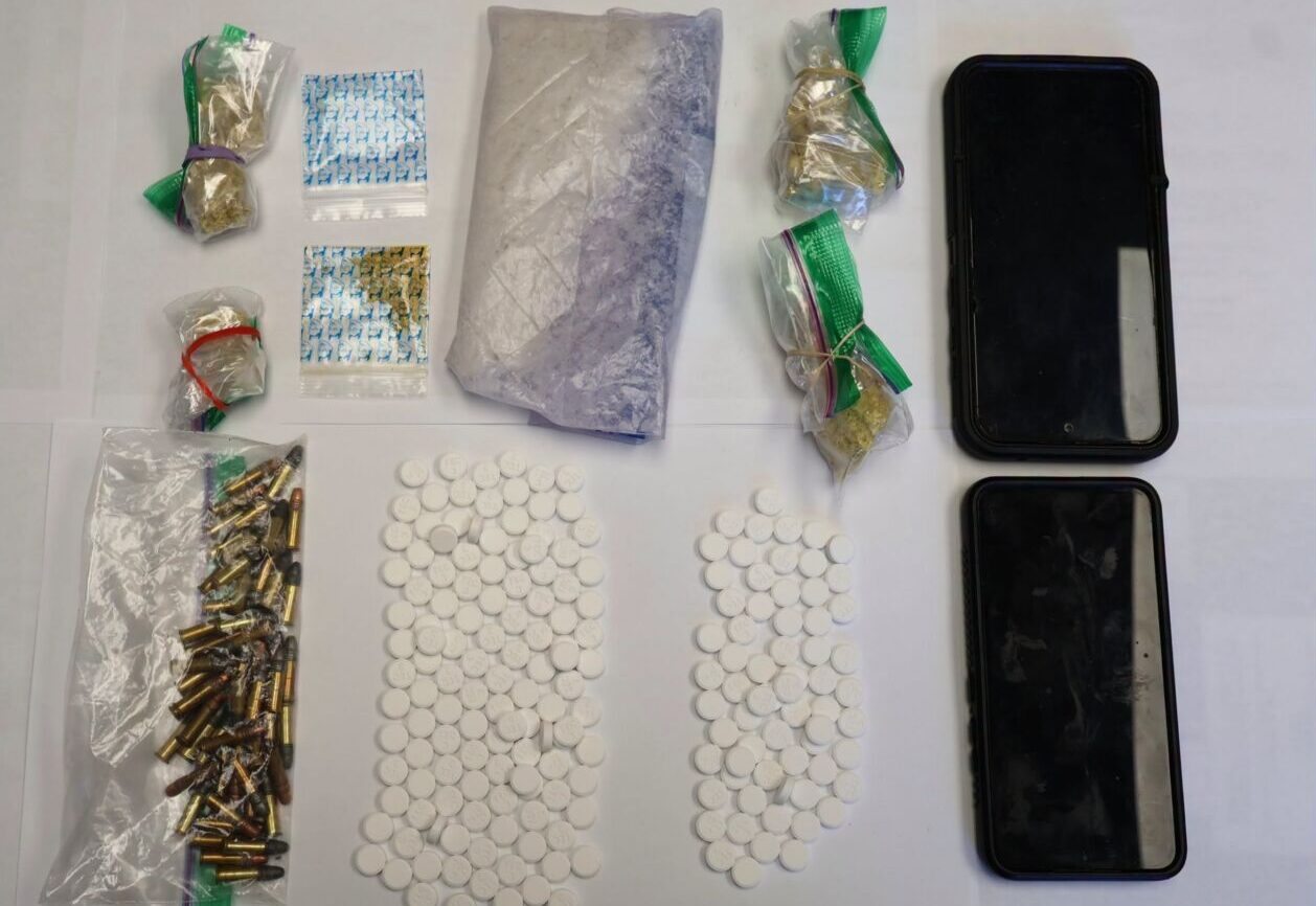
Four charged with drug trafficking by Anishinabek Police after stop in Lambton Shores
July 24, 2026
The Independent Four people have been arrested after a drug trafficking investigation that started in May and ended with a traffic stop in Lambton Shores July 21. Anishinabek Police Service officers stopped a vehicle in Lambton Shores July 21. Police searched the vehicle and found seven grams of fentanyl and 51 hydromorphone tables. A 57-year-old man and 43 year-old woman,
Read More
Front Page
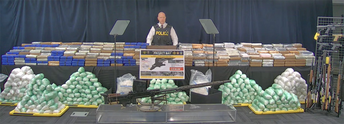
Bluewater Bridge border guards seized 1.1 tonnes of drugs in $139 million bust
July 24, 2026
Heather Wright/The Independent About 1.1 tonnes of the drugs seized in a $139 million drug investigation were seized at the Bluewater Bridge. And a Corunna man is one of 21 people charged in the massive drug ring which netted a total of 1.7 tonnes of cocaine, methamphetamine, opium and oxycodone. The investigation began in Windsor in January 2025. “At that
Read More

Front Page
Ashley Norton Caught the Ace
July 24, 2026
Imperial Oil employee takes home $4.5 million in Sarnia Legion Cathy Dobson & Heather Wright/The Independent After 45 weeks, hundreds of thousands of tickets sold, food banks restocked and a whole lot of fun, the Chase for the Ace is over. Thursday, Ashley Norton’s ticket was drawn at the Sarnia Legion. The 44-year-old Imperial Oil maintenance manager chose envelope number
Read More