Economic relationship between Port Huron and Sarnia-Lambton ‘decimated’ says US official

Heavy rain likely to cause more flooding
March 10, 2026
The St. Clair Region Conservation Authority says Environment and Climate Change Canada has issued a rainfall warning for the region, with 20 to 40 mm of rainfall from Tuesday night to Wednesday. Locally higher amounts of rain are possible in areas that receive thunderstorms. Heavy downpours may cause flash floods and water pooling on roads. Localized flooding in low-lying areas is possible.
Due to the recent snowmelt and rainfall, the watershed is seeing areas of ponding, standing water, and localized flooding in low-lying areas. Watercourse levels have been falling since peak levels reached Sunday but remain high going into another significant rainfall event. The ground is saturated and will not have the ability to soak up more water. Water levels are expected to start rising again Wednesday and remain high into next week. Depending on the timing and amounts of rain received, water levels could rise rapidly.
Of note is that temperatures are expected to return to the freezing mark by late Wednesday night and will hover close to freezing through to Friday morning. This should help slow the generation of runoff contributing to watercourses.
Officials remind you to avoid watercourses and flooded areas due to dangerous conditions, slippery banks, unsafe ice cover and cold, swift-moving water. Children and pets should be kept away from the water.
There are several road closures already in St. Clair Township, Stanley Line between Kimball Road and Waubuno Road
NEXT
CEEH foundation merging with Bluewater Health
PREVIOUS
One in four Lambton families food insecure
Front Page
Economic relationship between Port Huron and Sarnia-Lambton ‘decimated’ says US official
July 21, 2026
Sixty per cent of Port Huron business came from Sarnia-Lambton; today, it’s just 10 Cathy Dobson/Local Journalism Initiative Port Huron business and tourism reps were in Point Edward Tuesday, attempting damage control a day after American President Donald Trump threatened a new round of tariffs. “The majority of folks in Port Huron are thankful when (Canadians) are there,” said Michael
Read More

Front Page
No one’s too young to make their case to Sarnia council
July 21, 2026
Cathy Dobson/Local Journalism Initiative Eleven-year-old Grant Eddie spoke before Sarnia city council Monday, fighting to keep his basketball hoop on his family’s boulevard and is presentation was a slam dunk. “I’m really sad we’d have to take down our basketball net,” Grant told council, standing at the podium with his 13-year-old brother, Lucas, and his parents, Emily Grant and Christian
Read More
Front Page
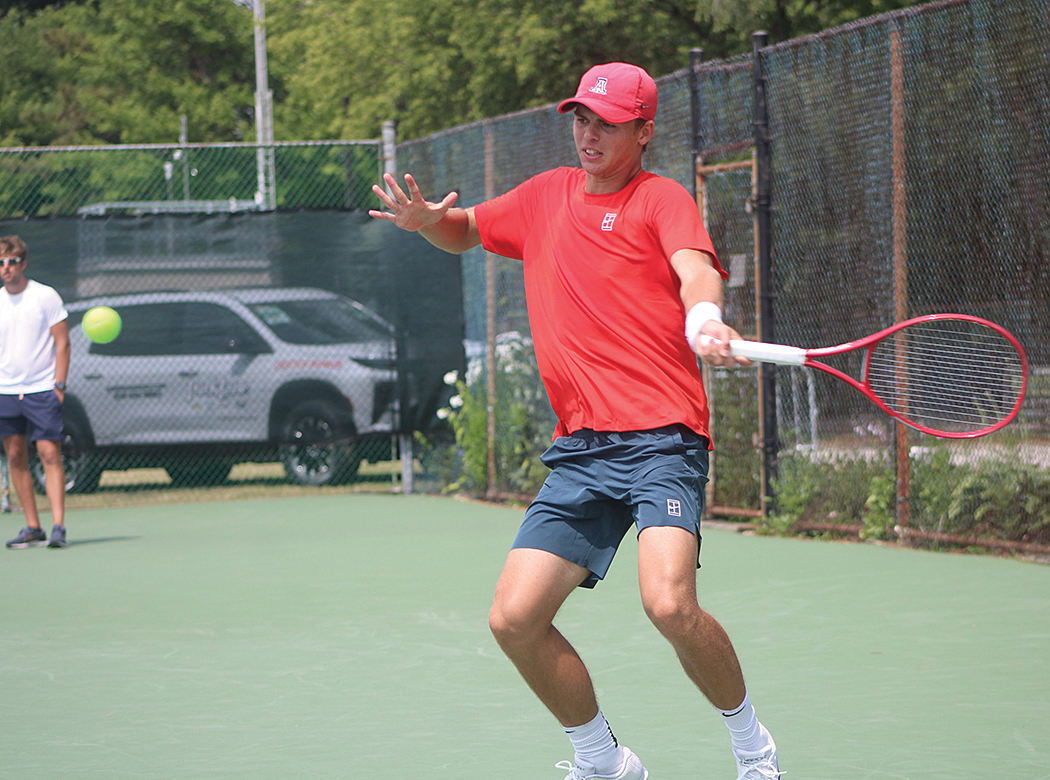
Kask wins smoke-delayed Bourassa Memorial
July 21, 2026
Blake Ellis/The Independent Matthias Uwe Kask beat Sachiv Kumar two sets to one in the final of the third-annual Love All Justin Bourassa Memorial Tournament Monday. Kask was ranked first and Kumar ranked second among the more than 40 competitors in the Ontario Tennis Association Men’s Open sanctioned event. Kumar took the first set 6-3 before Kask came back taking
Read More

Front Page
A salute to retiring politician after more than a half century of service
July 21, 2026
Dave Boushy was first elected in 1964 Cathy Dobson/Local Journalism Initiative He didn’t attend his final scheduled meeting of Sarnia council Monday, but Councillor David Boushy was recognized by his colleagues for serving his community for more than 50 years. A motion made by Councill Terry Burrell congratulated Boushy on his “great work.” Burrell asked that Boushy receive recognition with
Read More