Land for Forest Road/London Line roundabout not purchased yet

St Clair Region Conservation Authority records 100 mm of rain in 24 hours – flooding occurring on local roads
September 22, 2021
FROM THE ST CLAIR REGION CONSERVATION AUTHORITY
Highlights:
- Upwards of 100 mm of rain in the past 24 hours
- Additional 20-40 mm of rain expected in the next 12 hours
- Water levels rapidly rising, potential for impacted roads
Gauges within the watershed are reporting upwards of 100 mm of rain since yesterday. An additional 20-40 mm of rain is anticipated over the next 12 hours.
Water levels are rising quickly and breaching bankfull limits. The upper reaches of the Sydenham River are anticipated to peak early Thursday morning, followed by mid-watershed areas late Thursday morning to mid-afternoon. As the water moves through the system, water levels in the lower reaches near Dresden and Wallaceburg are anticipated to peak late Thursday evening.
The following roads are anticipated to be impacted by flooding:
- Stanley Line between Kimball Road and Waubuno Road
- Pretty Road north of McCallum Line
- Waterworks Road north of Courtright Line
Residents are reminded to avoid shorelines, watercourses and flooded areas due to dangerous conditions, slippery banks and cold, swift moving water. Children and pets should be kept away from the water.
The Conservation Authority continues to monitor watershed conditions and will issue advisories to municipalities and media should flood issues arise.
Municipal emergency response staff and road superintendents should monitor local conditions closely.
This remains in effect until Friday.

Front Page
Land for Forest Road/London Line roundabout not purchased yet
July 28, 2026
Road resurfacing project in the area starts Aug. 4 Heather Wright/The Independent A $1.8 million road reconstruction project at Forest Road and London Line won’t include a new roundabout. The project to recycle and repave about six kilometres of London Line and another two kilometres on Forest Road begins Aug. 4. But county officials say the $2.6 million roundabout is
Read More
Front Page
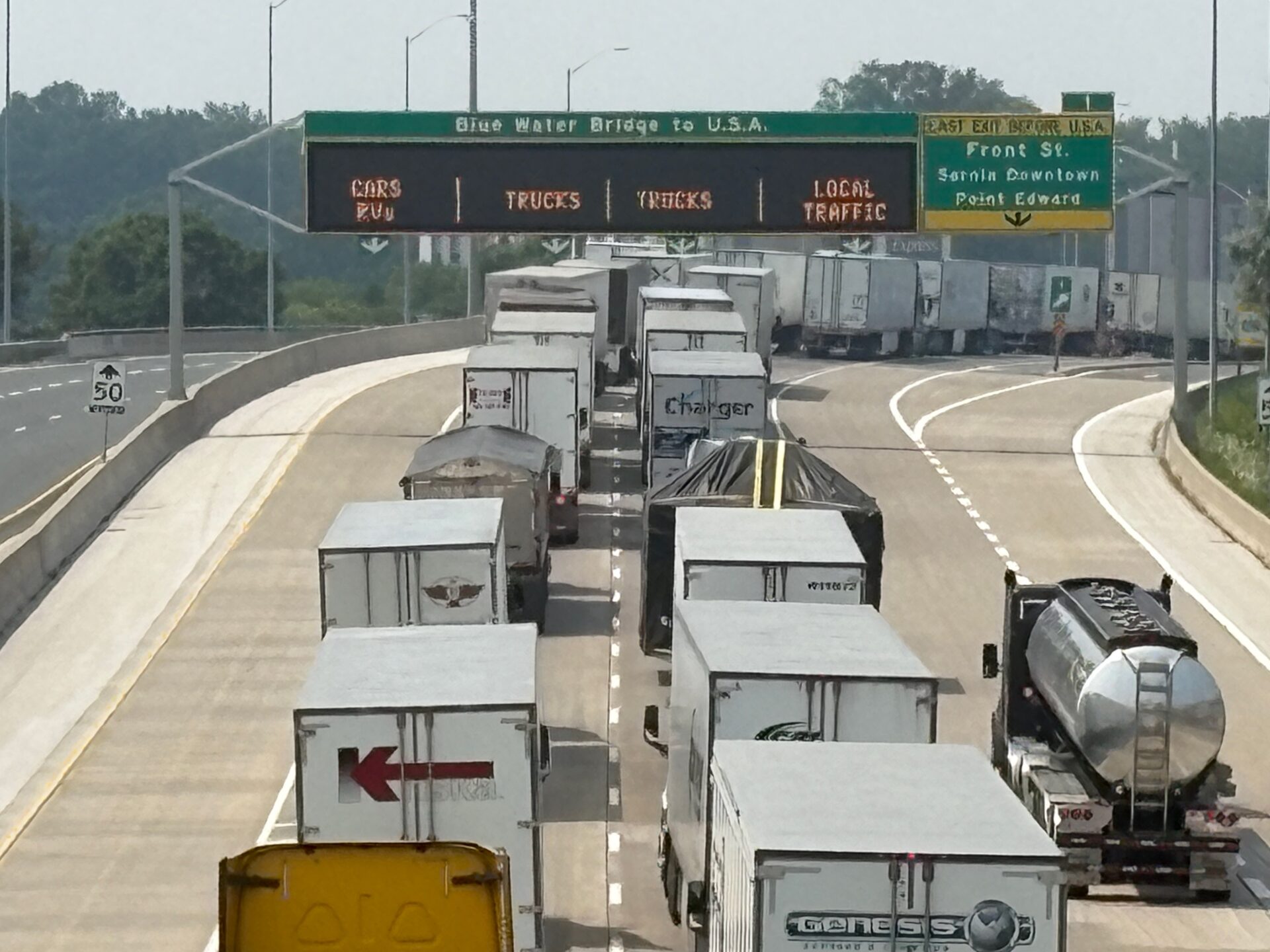
Highway 402 traffic will slow starting at Modeland Road
July 28, 2026
Province revises plans for 110 km/h speed limit near the Bluewater Bridge Heather Wright/The Independent A plan to increase the speed on Highway 402 westbound to just before the Bluewater Bridge have changed. Ontario first increased the speed limit on Highway 402 to 110 km/h during a pilot project on in 2019 and made it permanent in 2022. By the
Read More

Front Page
Dane Nisbet to be honoured by Sarnia Hockey Association
July 27, 2026
Barry Wright/The Independent The board of Sarnia Hockey Association has unanimously approved a plan to have its teams were a memorial patch on its uniform shoulder in honour of Dane Nisbet this season. All A/AA, B/BB and MD teams will wear the patch that has been approved by the Dane’s mom, Tracy. Nisbet is a graduate of Sarnia minor hockey
Read More

Front Page
Sarnia man faces weapons charges after vehicle hit with shotgun blast
July 27, 2026
The Independent A 47-year-old Sarnia man is facing weapons charges after shots were fired at a vehicle on Overlea Crescent. July 23, Sarnia Police were called to a home after a resident found multiple holes in the rear driver’s side door of the vehicle. Neighbours reported hearing gunshots in the area around 10:40 pm the night before. No one was
Read More