Four charged with drug trafficking by Anishinabek Police after stop in Lambton Shores
Warwick hit heavy again by rain
April 3, 2025
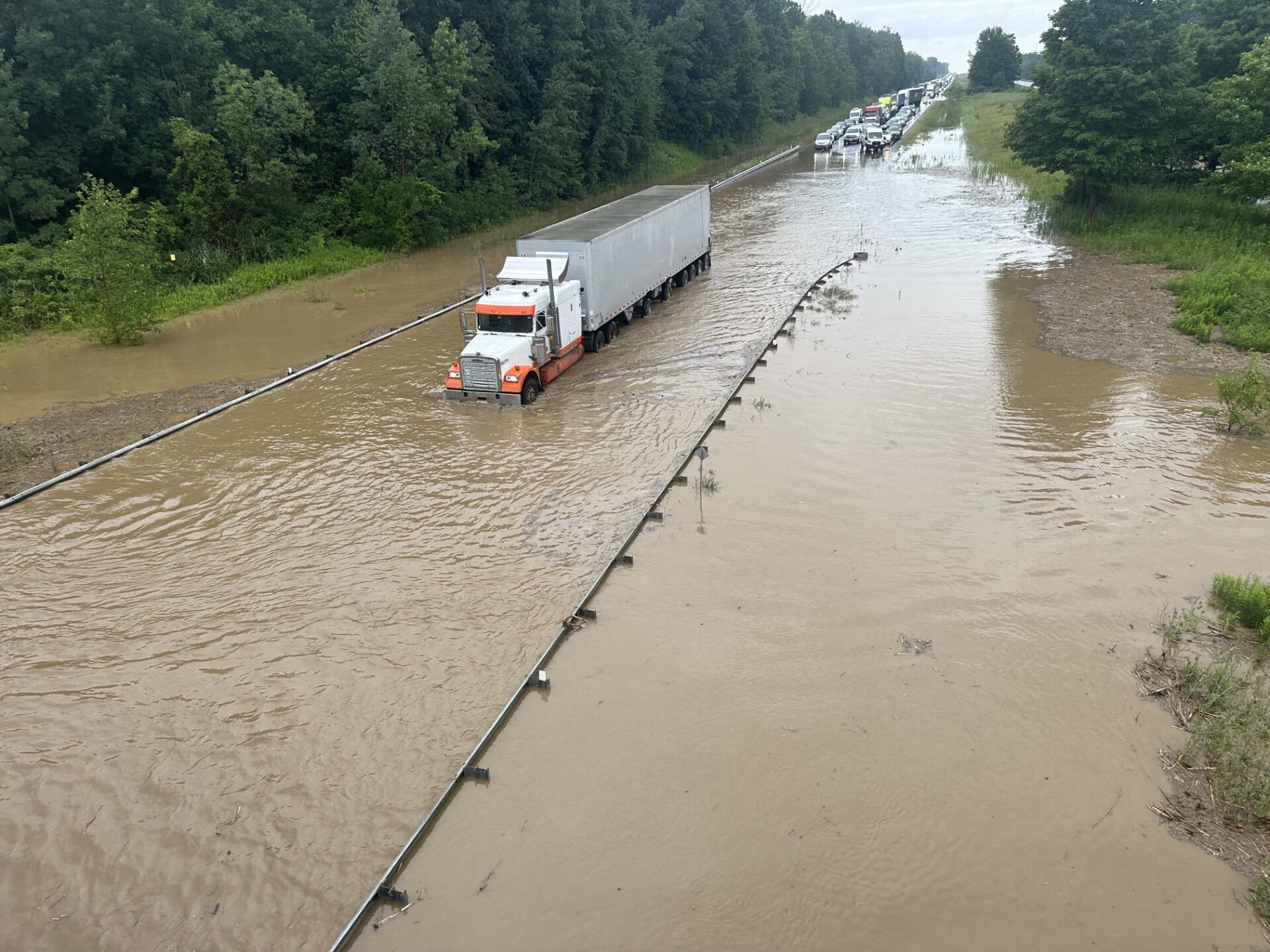
It appears Warwick Township is getting the worst of this rain.
The St. Clair Region Conservation Authority, in a flood alert says about 20 to 35 mm of rainfall Wednesday “with some weather stations reporting upwards of 50 mm north of Highway 402 near Warwick. The township has had two major floods in the past two summers.
Environment Canada is expecting an additional 15 to 40 mm of rain into Thursday.
Here’s the full advisory.
Highlights:
- 20 to 35 mm of rainfall received today across most areas
- An additional 15 to 40 mm possible over the next 4 to 6 hours
- Water levels are rising quickly, roads likely to be impacted
- Saturated conditions, increased runoff
A low pressure system tracking from the southwest has brought 20 to 35 mm of rain today, with some stations reporting upwards of 50 mm north of Highway 402 near Warwick. A Rainfall Warning remains in effect from Environment Canada, with an additional 15 to 40 mm of rainfall forecast for late this evening and into early Thursday.
Environment Canada has also issued a Severe Thunderstorm Watch for this evening, which could produce locally higher amounts of rainfall. At present, weather models are predicting rainfall intensities of upwards of 15 mm/hour just after midnight. High amounts of rainfall in a short period of time can lead to increased runoff and flash flooding, particularly in urban areas. Soils are expected to be saturated from the rain and could contribute to ponding, increased runoff into watercourses, and possible increased erosion and seepage issues.
Winds are forecast to be from the south/southwest and could gust upwards of 90 km/h at the height of the event. Winds from a south or westerly direction can cause a backwater effect in the Wallaceburg area, which could slow the flow of water out of the Sydenham River and contribute to elevated water levels.
Water levels are quickly responding to today’s rain, elevating into natural floodplain areas, parks and farm fields. As levels continue to rise, the following roads may be impacted:
- Telfer Road between Courtright Line and Moore Line
- Waterworks Road north of Courtright Line
- Fairweather Road Between Rokeby Line and Shiloh Line
- Fairweather Road between Oil Springs Line and Aberfeldy Line
- Stanley Line between Kimball Road and Waubuno Road
- Pretty Road north of McCallum Line
- Plowing Match Road between Petrolia Line and Rokeby Line
Individuals are reminded to avoid watercourses and flooded areas due to dangerous conditions, slippery banks, and cold, swift moving water. Children and pets should be kept away from the water.
The Conservation Authority continues to monitor watershed conditions and will issue advisories to municipalities and media should flood issues arise. Municipal emergency response staff and road superintendents should monitor local conditions closely.
NEXT
St. Clair lost 1.5 M cubic meters of water in 2024
PREVIOUS
Six Petrolia charities receive funding from community foundation

Front Page
Four charged with drug trafficking by Anishinabek Police after stop in Lambton Shores
July 24, 2026
The Independent Four people have been arrested after a drug trafficking investigation that started in May and ended with a traffic stop in Lambton Shores July 21. Anishinabek Police Service officers stopped a vehicle in Lambton Shores July 21. Police searched the vehicle and found seven grams of fentanyl and 51 hydromorphone tables. A 57-year-old man and 43 year-old woman,
Read More
Front Page
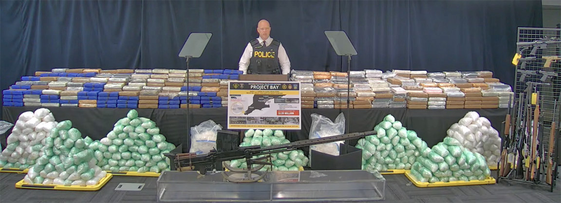
Bluewater Bridge border guards seized 1.1 tonnes of drugs in $139 million bust
July 24, 2026
Heather Wright/The Independent About 1.1 tonnes of the drugs seized in a $139 million drug investigation were seized at the Bluewater Bridge. And a Corunna man is one of 21 people charged in the massive drug ring which netted a total of 1.7 tonnes of cocaine, methamphetamine, opium and oxycodone. The investigation began in Windsor in January 2025. “At that
Read More

Front Page
Ashley Norton Caught the Ace
July 24, 2026
Imperial Oil employee takes home $4.5 million in Sarnia Legion Cathy Dobson & Heather Wright/The Independent After 45 weeks, hundreds of thousands of tickets sold, food banks restocked and a whole lot of fun, the Chase for the Ace is over. Thursday, Ashley Norton’s ticket was drawn at the Sarnia Legion. The 44-year-old Imperial Oil maintenance manager chose envelope number
Read More

Front Page
Oil Springs Youth Centre may be OPPs remote workplace
July 23, 2026
Blake Ellis/The Independent A request from the Lambton OPP for a secure, remote workplace has led the Oil Springs council to suggest the OPP use the youth centre in the village. The suggestion was made at the July 14 council meeting, when council reviewed the request from Lambton OPP Operational Support Sergeant Michael Marsh. “I like the idea because they’re
Read More