Former Courtright haunt of Al Capone being demolished

St. Clair Region Conservation Authority issues a flood watch until Saturday
February 17, 2022
Highlights:
- 20 mm rain received last 24 hours
- Water levels rising quickly, minor flooding and ponding
- Deteriorating ice and possible jamming
- Strong northerly winds gusting upwards of 70 km/h
- Roads may become impacted
A Winter Storm Warning from Environment Canada remains in effect as a low pressure system tracking through Southern Ontario continues to bring strong winds and mixed precipitation. Gauges across the watershed are reporting an average of 20 mm of rain received since yesterday evening, which has reduced the majority of snowpack in the region. Water levels at all stream gauges are steadily rising from the rain and snowmelt, and widespread ponding and minor flooding into natural floodplain areas is occurring. Ice jams are possible as breaking and shifting ice begins moving through the river system.
Winds over Lake Huron are northerly with sustained winds upwards of 50 km/h and gusts between 60 and 70 km/h, continuing overnight into early Friday when winds will start to dissipate. Waves are predicted to be 2-3 m on Lake Huron during the event. Strong winds and waves may shift ice, and northerly winds could promote the movement of ice from Lake Huron into the St. Clair River where it could build up and impact flow.
As water levels continue to rise, the following roads may become impacted:
- Stanley Line between Kimball Road and Waubuno Road
- Pretty Road north of McCallum Line
- Waterworks Road north of Courtright Line
- Tefler Road between Courtright Line and Moore Line
Individuals are reminded to avoid shorelines, watercourses and flooded areas due to dangerous conditions, slippery banks and cold, swift moving water. Children and pets should be kept away from the water and off of frozen waterbodies.
The Conservation Authority continues to monitor watershed conditions and will issue advisories to municipalities and media should flood issues arise. Municipal emergency response staff and road superintendents should monitor local conditions closely.
NEXT
Farm worker rescued after falling into grain bin
PREVIOUS
Two people dead, another missing in Wallaceburg fire

Front Page
Former Courtright haunt of Al Capone being demolished
July 24, 2026
The Independent The home of the first business in Courtright – said to be the former haunt of gangster Al Capone – is being torn down. Demolition of what once was the Cathcart General Store started July 21. Local historian Kip Cuthbert says the building dates back to around the 1850’s as a general store. “William Cathcart established his general
Read More
Front Page
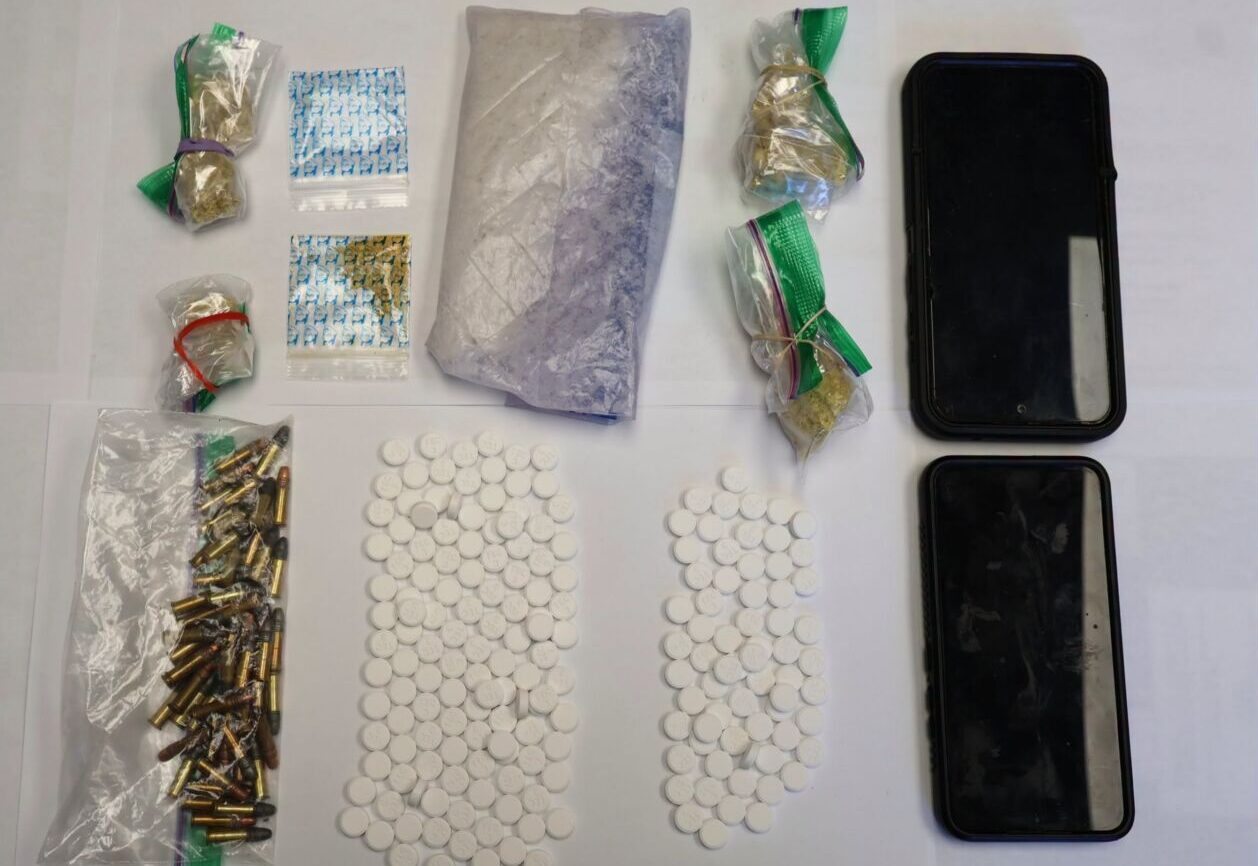
Four charged with drug trafficking by Anishinabek Police after stop in Lambton Shores
July 24, 2026
The Independent Four people have been arrested after a drug trafficking investigation that started in May and ended with a traffic stop in Lambton Shores July 21. Anishinabek Police Service officers stopped a vehicle in Lambton Shores July 21. Police searched the vehicle and found seven grams of fentanyl and 51 hydromorphone tables. A 57-year-old man and 43 year-old woman,
Read More
Front Page
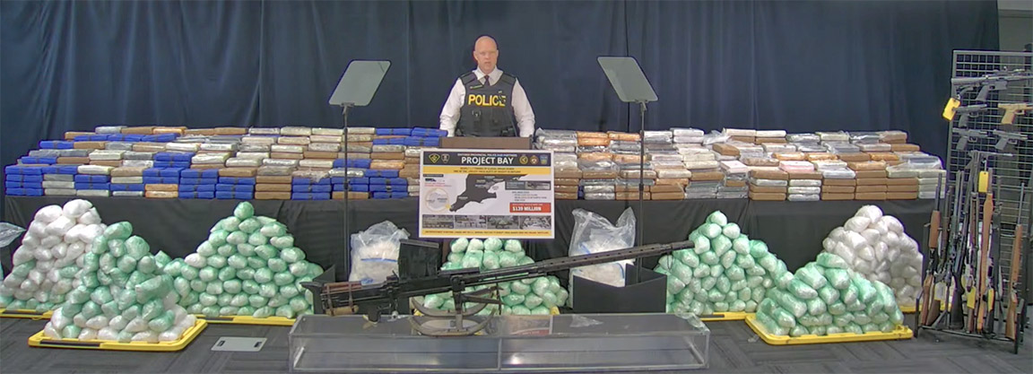
Bluewater Bridge border guards seized 1.1 tonnes of drugs in $139 million bust
July 24, 2026
Heather Wright/The Independent About 1.1 tonnes of the drugs seized in a $139 million drug investigation were seized at the Bluewater Bridge. And a Corunna man is one of 21 people charged in the massive drug ring which netted a total of 1.7 tonnes of cocaine, methamphetamine, opium and oxycodone. The investigation began in Windsor in January 2025. “At that
Read More

Front Page
Ashley Norton Caught the Ace
July 24, 2026
Imperial Oil employee takes home $4.5 million in Sarnia Legion Cathy Dobson & Heather Wright/The Independent After 45 weeks, hundreds of thousands of tickets sold, food banks restocked and a whole lot of fun, the Chase for the Ace is over. Thursday, Ashley Norton’s ticket was drawn at the Sarnia Legion. The 44-year-old Imperial Oil maintenance manager chose envelope number
Read More